Description
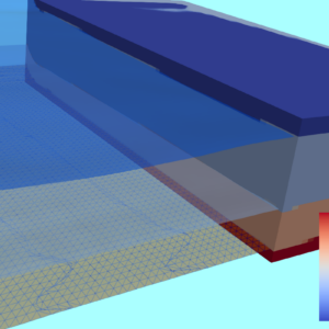
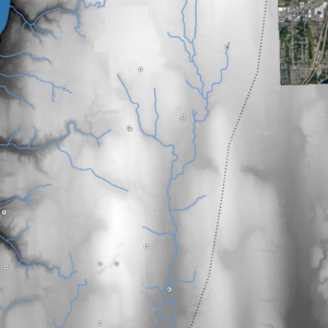
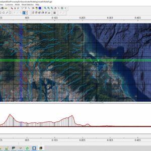
The webinar will cover introductory concepts of Geopandas, it will work with point, line and polygon vector data, create plots, simplify vertices and perform geospatial queries over inundated facilities and highways

$20.00
The webinar will cover introductory concepts of Geopandas, it will work with point, line and polygon vector data, create plots, simplify vertices and perform geospatial queries over inundated facilities and highways
The webinar will cover introductory concepts of Geopandas, it will work with point, line and polygon vector data, create plots, simplify vertices and perform geospatial queries over inundated facilities and highways

Reviews
There are no reviews yet.