
-
Open webinar: Maps of Days without Rain generation with Python and Rasterio, 20 Mar 2024
Water resurces management requires not only some direct values as precipitation amounts but also more elaborated data as days without rain. Based on the CHIRPS dataset for year 2022 stored…
-
Open webinar: PEST model calibration of a transient pumping test on Model Muse – 23 Feb 2024
We have developed an applied case of automatic calibration with PEST over a MODFLOW 6 model for a pumping test. The model represents a 72 hour pumping test over a…
-
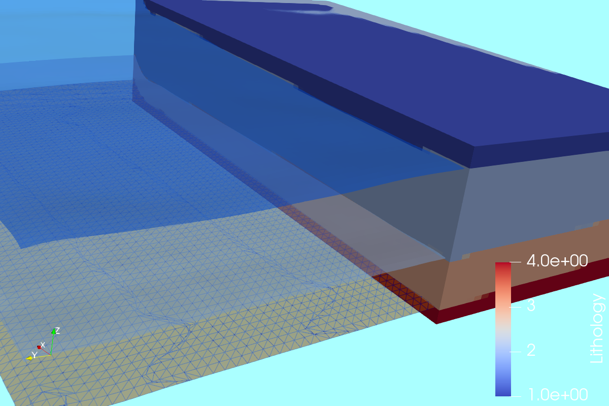
Geological modeling of sedimentary layers from geospatial rasters with Python and Gempy
The distribution of geological units over different depths on an area of interest is often needed as an input for other numerical models. Sources of data for geological modeling are…
-
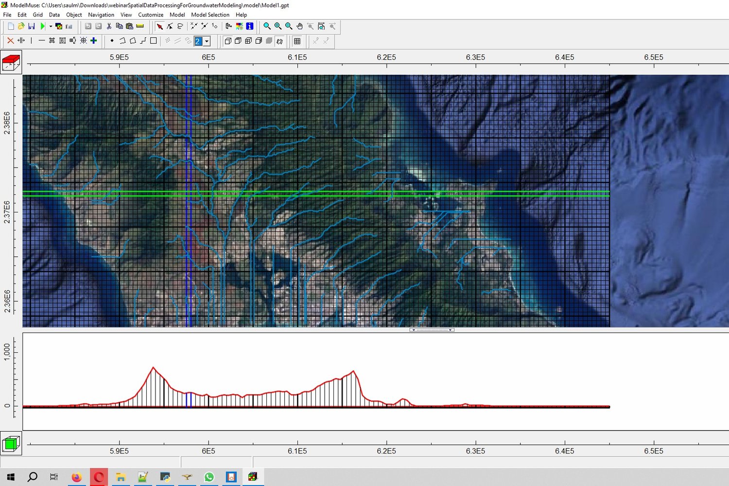
Spatial data processing for groundwater modeling in Model Muse
Groundwater model creation requires a complete set of spatial data for the different hydraulic parameters, boundary conditions and other model items. Vector and raster data need to be preprocessed, converted,…
-
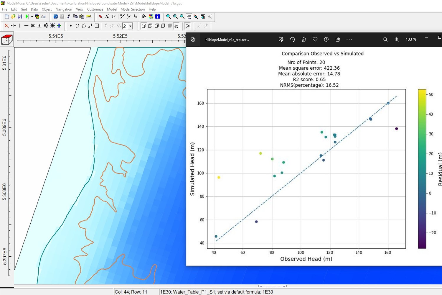
Calibration of Hillslope Groundwater MODFLOW 6 Model with Model Muse and Pest
We have developed an applied case of automatic calibration with Pest on a hillslope groundwater flow Model build with MODFLOW 6 and Model Muse. This webinar shows the entire process…
-
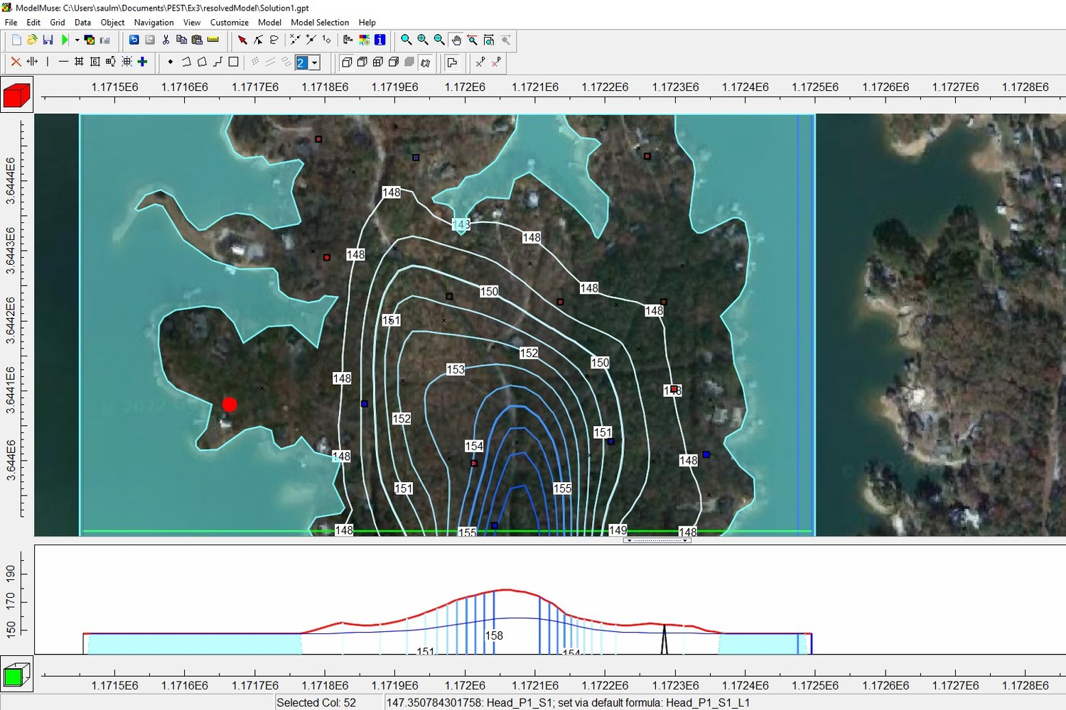
Distributed parameter estimation using pilot points of a MODFLOW 6 – PEST model
An applied example of the implementation of pilot points of PEST for the hydraulic conductivity on peninsula groundwater flow model. Content: – PEST simulation with 20 observation points – Definition…
-
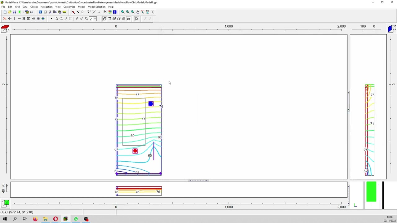
Automatic calibration of MODFLOW 6 with Pest in heterogeneus media with two observation types
Example of a multilayered groundwater flow model that has regional flow from a general head to a interpolated over vertex heads with recharge and drain boundary conditions. Content
-
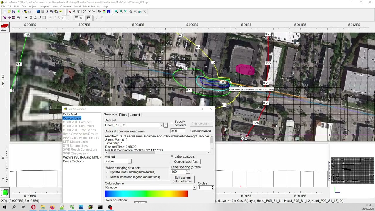
Modeling trench excavation with a flow barrier (HFB) in Modflow 6 on a quadtree mesh
Transient simulation of a trench excavation with a flow barrier in Modflow 6. The main purpose of the use of a HFB is to prevent the extension of the depression…
-
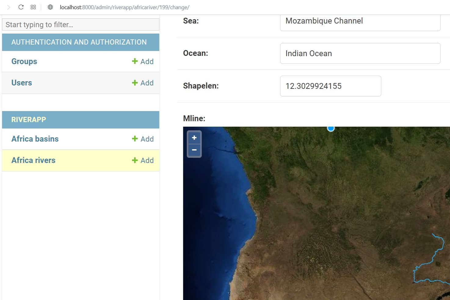
Development of a Postgis database for a geospatial Django web application
Development of geospatial web frameworks was always from our interest and we were always on the search for efficient tools for data management / data representation and that means a…
-
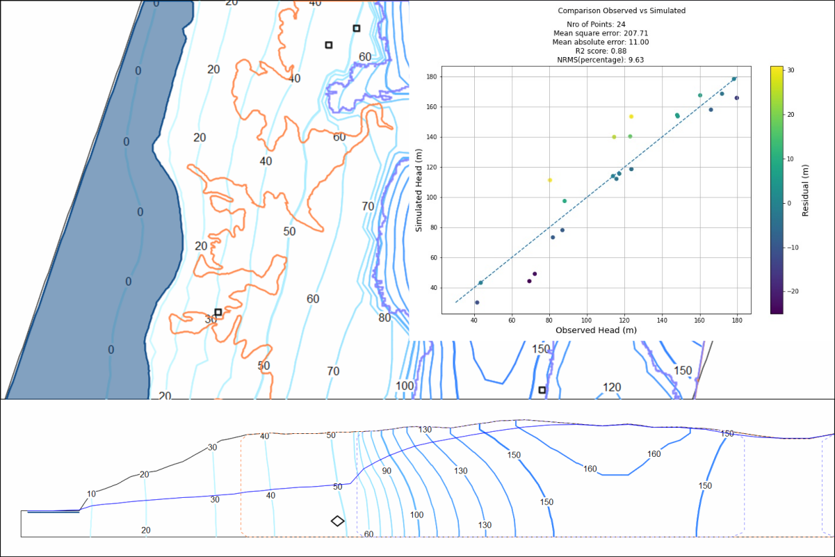
Calibration of a Groundwater Flow Model in MODFLOW 6 with Model Muse and Python
Calibration of hydrogeological models can be defined as the procedure to adjust the hydraulic parameters of the model where the resulting heads and flows are close to the observed values.…